信息图
界面稿
故事叙事
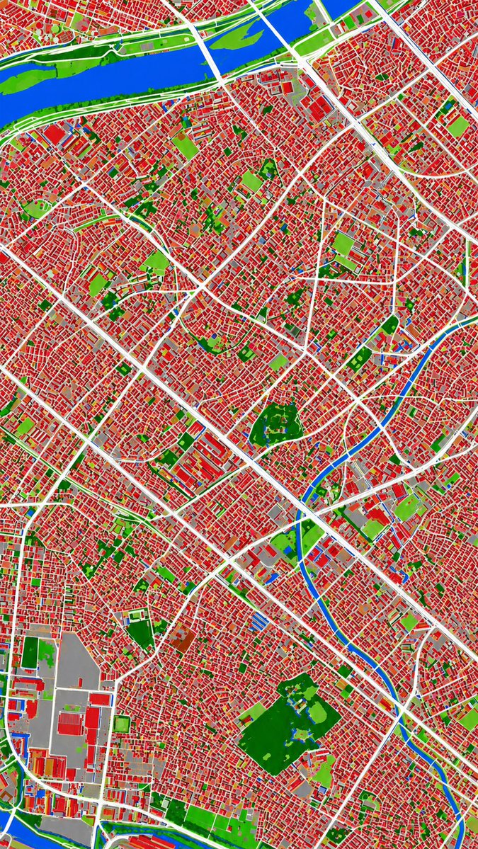
信息图 GPT Image 2 提示词:Aerial Photo to Land-Cover Map
This prompt converts a reference aerial photograph into a false-color land-cover classification map for urban analysis or map-style visualization.
📝 提示词
Using REFERENCE_0 as the source geography and urban layout, transform the monochrome historical aerial photo into a clean land-cover classification map using the false-color visual language implied by REFERENCE_1. Keep the same top-down viewpoint and street/block structure, but replace photographic texture with flat segmented regions and crisp boundaries. Classify the scene into exactly 6 visual categories: 1) buildings as red, 2) roads and major paved corridors as white, 3) water bodies and canals as blue, 4) dense vegetation/parks as dark green, 5) open grass or sparse green areas as light green, and 6) industrial or large paved/open facility areas as gray. Produce a dense urban thematic map with strong contrast, minimal shading, and no labels, legends, borders, or photographic film markings.
🎯 适合场景
适合做图解、清单、路线图和知识长图:先锁定信息层级,再把文字量控制在模型能稳定处理的范围里。
💡 改写建议
- 先替换变量里的品类、人物、城市、品牌色,不急着改整段结构。 把主体、构图和风格分开写,后续微调会更稳。